
Project Grants
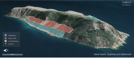
A Quarry Island in Isauria (Türkiye): On the Trail of Dana Island’s Byzantine Stonecutters / Günder Varinlioğlu (2019–2020)
The limestone quarries of Dana Island (ancient Pityoussa) in Isauria, Rough Cilicia, southern Türkiye, are among the largest known sources of building materials in the Mediterranean dating to the early Byzantine period (4th to 8th centuries CE). The island benefited from the intensification of Mediterranean maritime networks after the foundation of the new imperial capital in Constantinople, which fostered economic growth and construction booms across the empire, creating an unprecedented demand for building stone. People responded to this demand by building a large settlement on Dana Island, supporting an extensive quarrying industry, which could export material directly by sea. This project aims to understand the development, capacity, and role of this island quarry and settlement in the intensive supply of ordinary building stone in the Byzantine world by investigating the processes, phases of production, and logistics of stone extraction and transport using innovative multi-disciplinary methods.
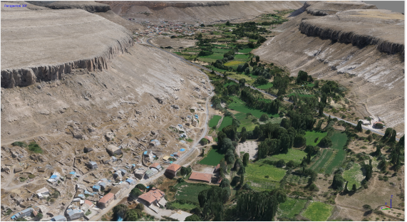
Baths and Bathing in East Crete During the Byzantine Period / Natali Poulou (2018–2019)
Loutres is a site on the northeast coast of Crete, 1.1 km east of the village of Mochlos and 33 km west of Siteia. It is an area covered with bushes on a ravine close to the coast on its north. From 2014 to 2018, a team from the Aristotle University of Thessaloniki, under the direction of Professor Natalia Poulou, carried out onsite archaeological investigations. The main collaborator of the excavation was A. Tantsis, architect and Assistant Professor on Byzantine Archaeology (Aristotle University of Thessaloniki). The excavation permits were provided by the Greek Ministry of Culture and Sports and the Ephorate of Antiquities of Lasithi. GABAM funded the excavations during the 2018 season.
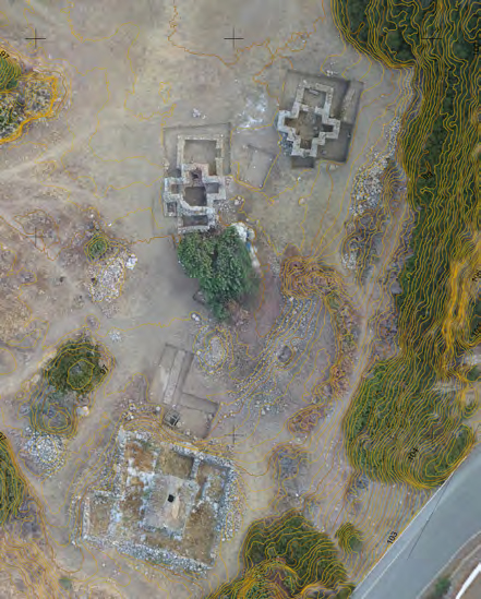
Digital Modeling and Interpreting Settlement Patterns in Byzantine Cappadocia: Dereköy (Potamia) Survey and Beyond / Tolga Uyar (2018–2019)
This project undertook a systematic GIS documentation, digital mapping and 3D modeling of the large medieval rock carved rural settlement in Dereköy covering the present-day villages of Güzelöz and Başköy where we had already conducted an exhaustive fieldwork. The project created as complete a record as possible of an entire settlement using only traditional surveying methods, because we had no access to expensive high technology equipment and recording methods. More than 100 burials, 36 churches, three of which are large masonry buildings, 32 large wine-making facilities, two mills and various utilitarian spaces were measured and their architectural drawings made by hand, and surface ceramics were collected. The large amount of data generated during the survey on the spatial, functional and temporal characteristics of the wall paintings, architectural features, and archaeological finds requires however, appropriate and up to date digital methods for handling this information effectively.